Langstrath to Keswick

From my hardest day to the easiest. The walk from the campsite through the tiny but charming village of Grange, all the way to Keswick, was like a walk through a park. I even bought an ice cream in Grange as the sun was so warm. The flavour was ‘chocolate toffee explosion’ or something equally exciting. Totally worth paying over two pounds for one rather small scoop.

I chatted to an older couple (you’d think there was no other type of people in this area, that’s how frequently I meet them) who told me that the Borrowdale Valley is often thought the prettiest square mile in Cumbria. I don’t know if that’s precisely true but it certainly wasn’t bad at all.

I stopped for an early lunch by an abandoned slate quarry and had a wander through.

On my first day in Ulverston I bought a chunk of cheddar to take with me on my walks and it lasted a surprisingly long time, especially since I didn’t have it in the fridge at all. Well, I mean night times were fridge temperatures, but it survived the days too. I would cut off bits to mix through couscous and it wasn’t a bad meal with an apple on the side. I am also loving my soft water bottles. They fit into any space in my bag and take up no room when they’re empty. I’m glad I chose those rather than the hard sort.

Here’s my first sight of Derwent Water.

Most of the rest of the day was taken up with meeting two more older couples. The first couple took my photo.

I think I look sort of happy-yet-pathetic in this picture.

The other couple were American and we talked and walked for about an hour and then we got to a little village right before Keswick and they bought me lunch! It was incredibly kind and I think I reminded them of their children, one was born the same year as me. They told me that if I couldn’t find accommodation I should come to their cottage and they would be happy to let me sleep on the couch.

People have been so generous and friendly and kind to me so far, I really can’t get over it.

I waved them farewell and headed to the lakeside campsite and found they had tonnes of room. I pitched my tent and revelled in the sunshine.

Here’s a few more photos from the day.

Splendid!

Langdale to Borrowdale: My Second Encounter With Mountain Rescue.

I caught the bus from Ambleside to The Old Dungeon Ghyll Hotel, a place I’ve heard a lot about as it appears on many UK hiking blogs. Because the first bus didn’t leave Ambleside until 9:30 and didn’t get to TODG until 10:30ish I didn’t go inside and now I’m kind of sorry. At the same time that day turned out to be the hardest slog yet so I’m glad I didn’t hang around.

The Langdale Valley on a sunny bank holiday Saturday is less a peaceful stroll through a stunning valley and more a walk along a busy high street. So many people! More than I’d seen on all the walks I’d done previously put together. At the end of the valley the track splits off in several directions though so that helped thin the hordes. Also at the end of the valley were a trio of mountain rescue vehicles and I learned from a conversation later in the day that it definitely wasn’t a drill and they’d been there since 8am. No idea what happened though.

As I faced the steep wall of Stake Pass I stopped thinking about other people and mainly started feeling sorry for myself. No one else was carrying a huge pack and it looked like maybe 1000 steps or more to the top, most of them moderately steep and all of them uneven.

I did find, once I got going, that is wasn’t so bad. Because the path had water running down it (they almost all do) and I had to look at every step for footing, I only ended up stopping a few times and with the view getting better and better, it was exciting to climb higher. I’ve never been great with heights but I think this experience is definitely helping me take more risks and be brave. I know some people would bound up stairs like that but for me it was a challenge. When I got to the top I felt like I’d conquered the world.

Over the top was an open grassland area for a short space. It was up here I met a group of uni students from Preston University. We swapped Instagram details at their insistence, then it was down into Borrowdale. Instead of uneven stone steps the path was loose gravel, which is my least favourite surface. I ended up walking on the grass edges on the narrow path that wiggled back and forth. I stopped halfway down and cooked some pasta (taking the advice of several people to actually have decent break when I felt tired) and while I did a man from, of all places, Redcar, came past. This was funny for me because Redcar is a tiny town in Yorkshire and Luke and I stayed in the nearby town of Saltburn last time we were here. The people we stayed with had nothing good to say about Redcar and made this point quite a number of times. Then I meet this guy and he said exactly the same thing.

We had a chat about things other than Redcar and he told me I should definitely do some wild camping at some stage and I agreed (we’ll see) then he moved on. I slowly inched my way down the slope and then struggled along the rocky and muddy valley floor. This was the point that I finally gave up trying to keep my feet dry and just walked through the mud. Within about two kilometres there were about 20 streams to cross and I managed most ok but it was slow going. I met an older couple (I should start tracking how many times I use that phrase) who told me this was as dry as it gets and quite often water is sheeting down the valley walls. Christ almighty.

The water was beautifully clear though.

I decided, as I always do, to stop at the first campsite I came to. It was pretty basic and so busy it looked like there was a music festival going on. I pitched my tent then went in search of the closest pub and had a pint of cider in their sunny beer garden. Lovely!

Surf Coast Walk: Day Two

I woke up face down, with my sleeping bag over my head and a strong suspicion that the air outside was freezing cold. I had managed to sleep for about 9 hours though, which is a champion effort for the first night in the tent.

img_1051

Sad face.

It took me an hour and a half to emerge and pack everything up. I ate one chocolate biscuit for breakfast because it’s the most important meal of the day, and was on the trail by 8:30.

The sun was shining, there was hardly anybody about – I felt great! The path from the campground heads north-east along a fairly flat trail until it starts to climb up the headland. There was a series of rough stone steps that were quite a struggle but the view at the top, back over Anglesea, was lovely.

Apparently people ride bikes up these steps. Because they are insane, I assume. 

Looking back towards Anglesea.

Down from the headland the path emerged onto a beach and mine were the first footprints of the day! It wasn’t a long stretch, but I enjoyed the feeling of solitude and admired a hut-shaped pile of driftwood that someone had constructed. At the far end of the beach a couple of Japanese tourists were climbing down the stairs. They said hello and I informed them that they would have the beach to themselves and I’m sure they were suitably impressed.

Pristine!

The path meandered on and eventually I found myself at the famous Bell’s Beach (famous if you are Australian or know anything about surfing). There were about half a dozen surfers braving the cold water, but the waves didn’t look particularly impressive. I had a rest and a drink at the lookout and considered the fact that I hadn’t eaten a proper meal yet, so at about 11am I made myself some porridge (burning it onto the bottom of the jetboil, exactly as I’d done on the last camping trip). I’d brought two sachets because they looked very small. Turns out they expand enormously but, like a trooper, I wolfed it all down and tried to ignore all the people walking past me who probably wondered why I was cooking white sludge on a park bench.

After I’d eaten I packed up and wandered on, but I got a bit confused and ended up doing a bit of road walking. I think this actually shortened my walk and, since there was almost no traffic, wasn’t too unpleasant. The hill I had to walk up was quite a killer though and I was extremely glad to get to the top and find a carpark that met the path.

Like some kind of alien muppet. Needs a pair of giant googly eyes. 

From there on there were a lot of spiny bush-things (I’m annoyed I didn’t find the name – if anyone knows please tell me!) that were quite sculptural in appearance. They were dotted between eucalyptus trees, which made for a nice visual contrast. There were also a lot of wildflowers.

When I emerged from this part of the trail I found myself on a section of coast where hang-gliding seemed to be quite popular.

As I came towards Torquay I stopped to take some photos of a glider who had just taken off and also have a chat with his mate, who was watching from below. Turns out he’d just done the Camino last year so we talked a bit about walking before I continued on.

The last leg was into Torquay via the beach and a path around the golf course. I kept going until I reached the esplanade and then found a restaurant/bar to dump my bag and order dinner. And what a dinner! It is so true that food after extended outdoor exertions always tastes amazing.

The second day of my walk had been at least 4km longer than the first day and I’d taken more rest stops. By the end my soles were sore and I was happy not to do the last few kilometres along the beach. I don’t know why the people who planned the path had it finish far beyond the last town centre and in a place where no buses or trains stop, but I’m not the kind of walker who feels the need to do things by the book so I was fine with an early finish.

Right when I finished dinner and my little wrap-up video, Jess called and said she’d be by to pick me up in 15 minutes. Perfect!

All in all, an excellent first experience of overnight hiking (well, ‘hiking’ is probably making it sound more rugged than it was) and I came home ready to do more, ASAP! I have a few walks in mind to tackle this year – something in The Grampians, part of the Mornington Peninsula circuit, and Oberon Bay at Wilson’s Prom. Or maybe something longer?

The Surf Coast Walk: Day One.

For my very first overnight solo hike I did a lot of researching and planning and decided on walking the Surf Coast, which stretches between Fairhaven in the south-west, and Torquay in the north-east. Here’s the (slightly blurry, apologies) map that the local council provides, and which turned out to be pretty much all I needed to do the walk.

Screen Shot 2017-09-27 at 7.46.09 pm

The first section I walked – Split Point to Anglesea. The yellow section is a massively long beach, on which I saw five people in the space of an hour. Magic!

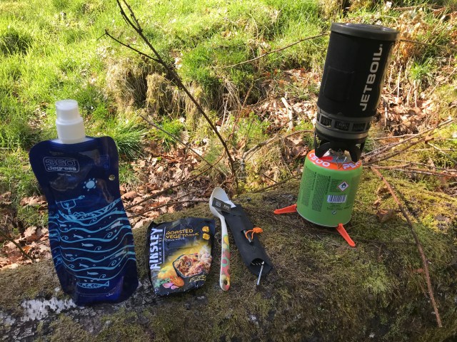
I have been accumulating gear throughout this year and now I have all the necessary basics  – bag, tent, sleeping gear and cooking equipment. I’ve tried to focus on ultralight principles (to some degree, anyhow) and so the items I have in those four categories altogether weigh around 5kgs.

On Monday it was time to try it all out for real!

My friend Jess has family in the lovely beachside town of Anglesea, which is about half way along the walk. I hitched a lift with her on Sunday night (Anglesea is about 1.5-2 hours from where we live in the eastern suburbs of Melbourne) and stayed the night there. Jess’ family are *lovely* – it’s always a pleasure to go stay and chat with her mum about gardening and travel and everything… and I’m not just saying that because Wendy will probably read this (*waves*!). Every time I go to Anglesea I think about how soon I can retire there;-). Apart from being beautiful it has a lovely community vibe and lots of environmentally-friendly things going on. My kind of place.

On Monday morning Jess kindly offered to drive me to the start point and come rescue me if anything went wrong. At the last minute I went through my pack and ditched maybe another kilo of gear (clothes, kindle case, toiletries) and then we were off!

Jess dropped me at the Split Point Lighthouse. I’d decided to cut a couple of km from one end of the walk as I was a bit nervous about being able to carry my 12+kg bag for 20 km (12.4 miles). Turns out I needn’t have worried, but it’s better not to start a new experience feeling nervous, I guess.

We had a a bit of a dither finding signage for the walk – it seems the sign makers envisaged people doing it Torquay to Fairhaven, and not so much the reverse, as I’d planned. Still, the people in the lighthouse cafe were helpful and I set out full of vigour!

Ten minutes in and the rain started. Fortunately the view along the coast allows for a lot of warning and so I had my raincoat out in plenty of time. I’d half hoped it would rain because I’m preparing for walking in the UK next year and I hate getting wet, so I’m trying to condition myself to getting out in all weather. It’s working pretty well, and it helps that I have a really top-notch Kathmandu raincoat that keeps everything above my knees completely dry.

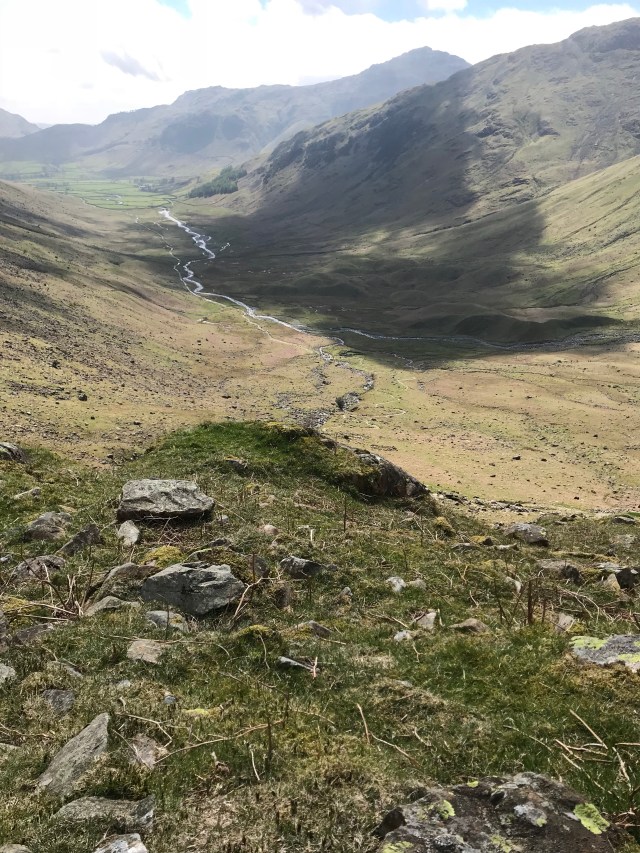
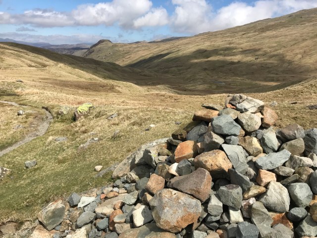
The first part of the walk is along the cliff-tops. The views are lovely and the cliffs are very orange when the sun shines on them. The sunlight and clouds made for great colours on the ocean and the hedging scrub was full of flowers. The whole two days of walking were filled with tiny flowers and I made a little collage when I finished:

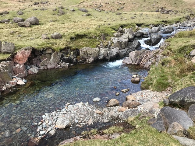
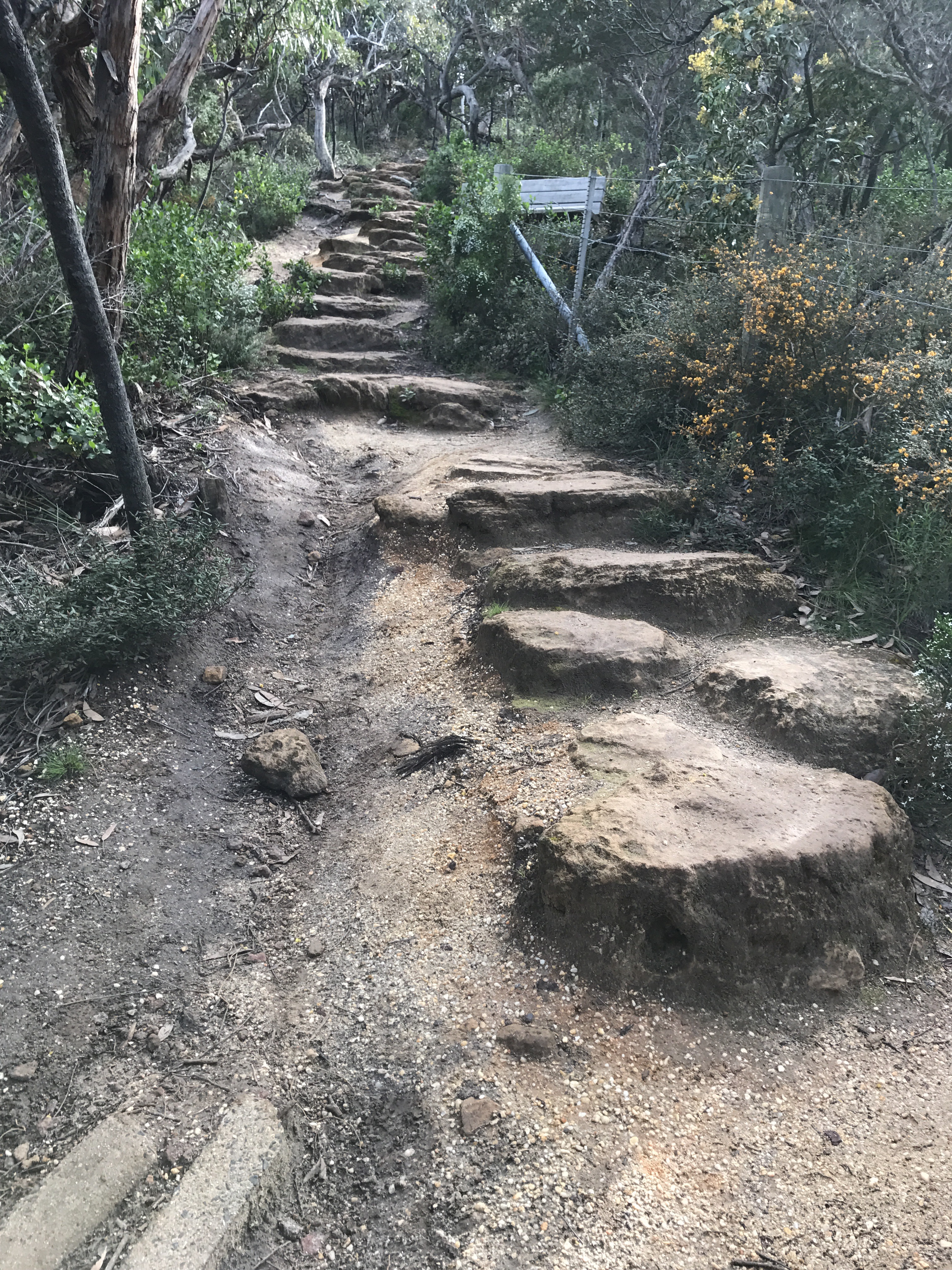
The walk detoured through little stands of moonah trees (a local species that is threatened with extinction), gum trees and then down onto beaches and up stairs and hills. There were a few muddy sections that made me glad I had my poles and waterproof trail-running shoes (not that I’ve ever run in them!).

One of my favourite parts of the day was a 4.5km stretch of beach where I saw almost no one. There was a bit of rain, but watching the birds and the waves and having it almost to myself – magic!

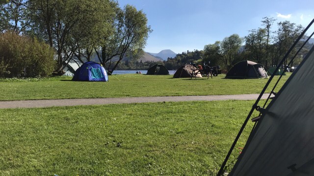
I’d set out at about 10am and had 15 km to walk to get to Anglesea where I’d booked a campsite at the caravan park. I had no idea how long it would take me but I was pretty sure I could get there by dark. I was pretty slow on the uphill stretches – carrying such a weight is a fairly new experience for me – but I made it to Anglesea at around 2:30pm. Much better time than I’d hoped! After getting a tiny bit annoyed at the $40 fee for camping (although they did have excellent facilities I only wanted the use of a toilet and sink), I spent a few minutes putting my tent up and then lay on my mat under my quilt (it was a cold and rainy afternoon) for two hours reading my kindle (Charles Stross, The Atrocity Archives – would recommend!) before venturing out for dinner.

I decided that, being by the beach, fish and potato cakes were in order. I also thought I deserved a packet of chocolate biscuits and a can of pre-mixed drink (to help me get to sleep – it was virtually medicinal). Now, Wendy had mentioned to me that Anglesea doesn’t do plastic bags but I had completely forgotten, so I left the fish and chip shop with an arm full of food. I ended up putting the cold things in the hood of my raincoat and warming my hands on the fried food package on the 500m walk back to the campsite. On the way I saw the brightest, clearest rainbow in a full arc across the sky over the headland. It was so incredible I just stood there and ate my potato cakes and admired it, even as the rain started up again.

Rather than get fish grease on my tent, I went for a wander around the campsite. It sits on a headland and has great beach access. The site also has more moonah trees and with the dusk light pouring through they looked quite eldritch. It was fabulous.

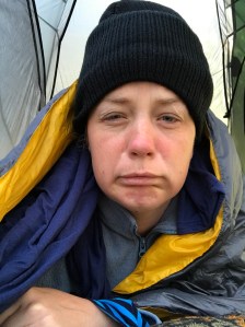
After a little walk on the beach I headed back to the tent and read for another couple of hours, setting up my selfie stick (I know, I know, but the tripod facility is really handy when you’re doing things solo, especially making videos) as a bedside light. It was freezing cold but my quilt and a beanie kept me warm enough, and I somehow managed to spread the entire contents of my pack throughout my tent during the night. It is hard to fathom how so little can make such a mess.

Anyhow, I finished my first day feeling pretty good. No blisters, no foot soreness, no major discomfort of any kind. From feeling somewhat hesitant that morning about my chances of successfully embarking on a couple of months of solo travel, I felt like I could DO IT! Maybe I won’t be climbing Snowdon… but who knows? Maybe I shall!

Photo Post. Fingers Crossed.

Please let the internet not swallow my post for the 10th time today!

In no particular order:

‘Beach Love’, where we have happy hour drinks every night before finding somewhere for dinner. That red lantern in the front created quite a bit of entertainment as we watched every dog on the beach pee on it in succession. There were other lanterns, mind, but this one was where it was at as far as the dogs were concerned.

IMG_4287

Nothing says ‘ostentatious’ like giant gold letters on a rock.


panviman sign


Our usual table at Beach Love. I tried to speak a few words of Thai to the waiter only to discover he was from Myanmar and didn’t speak Thai. Typical!


IMG_4283

A bit of dawn photography shennanigans. Look at me being all wistful and suchlike.


IMG_4351

Luke enjoys a plate of delicious treats from the breakfast buffet. ‘Breakfast included’ is one of my favourite phrases ;-).


IMG_4359

Sorry about the tiny photos, it’s on my list of Things To Learn About WordPress.

So what else have we been up to? A couple of massages, which probably doubles the number of massages I’ve had in my life. I wrote some postcards today, one of them to my dog. We’re leaving here tomorrow, which is sad because this is the lifestyle to which I’d like to become accustomed, but it’s probably a bit early for retirement and I’m keen to experience a different side to the island, something a bit livelier.

I’ll leave you with some Engrish spotted at the beach.

seen in Koh Phangan