Langstrath to Keswick

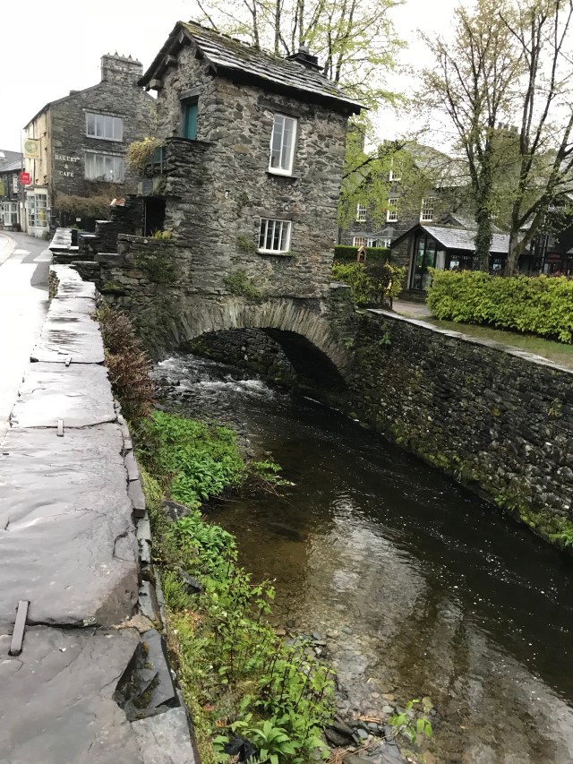
From my hardest day to the easiest. The walk from the campsite through the tiny but charming village of Grange, all the way to Keswick, was like a walk through a park. I even bought an ice cream in Grange as the sun was so warm. The flavour was ‘chocolate toffee explosion’ or something equally exciting. Totally worth paying over two pounds for one rather small scoop.

I chatted to an older couple (you’d think there was no other type of people in this area, that’s how frequently I meet them) who told me that the Borrowdale Valley is often thought the prettiest square mile in Cumbria. I don’t know if that’s precisely true but it certainly wasn’t bad at all.

I stopped for an early lunch by an abandoned slate quarry and had a wander through.

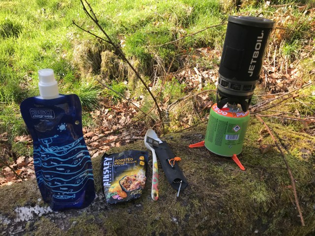
On my first day in Ulverston I bought a chunk of cheddar to take with me on my walks and it lasted a surprisingly long time, especially since I didn’t have it in the fridge at all. Well, I mean night times were fridge temperatures, but it survived the days too. I would cut off bits to mix through couscous and it wasn’t a bad meal with an apple on the side. I am also loving my soft water bottles. They fit into any space in my bag and take up no room when they’re empty. I’m glad I chose those rather than the hard sort.

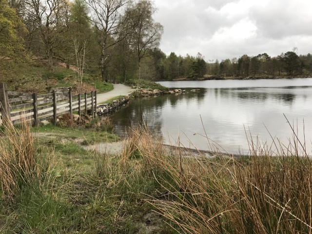
Here’s my first sight of Derwent Water.

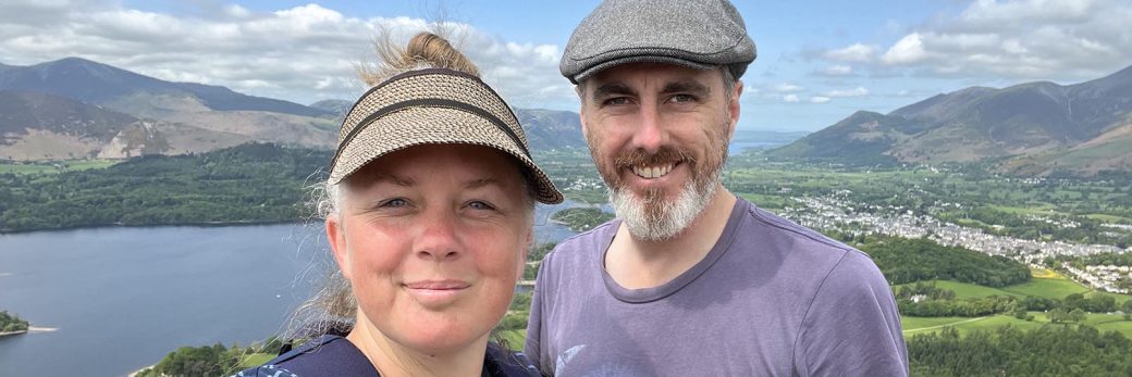
Most of the rest of the day was taken up with meeting two more older couples. The first couple took my photo.

I think I look sort of happy-yet-pathetic in this picture.

The other couple were American and we talked and walked for about an hour and then we got to a little village right before Keswick and they bought me lunch! It was incredibly kind and I think I reminded them of their children, one was born the same year as me. They told me that if I couldn’t find accommodation I should come to their cottage and they would be happy to let me sleep on the couch.

People have been so generous and friendly and kind to me so far, I really can’t get over it.

I waved them farewell and headed to the lakeside campsite and found they had tonnes of room. I pitched my tent and revelled in the sunshine.

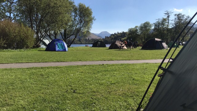
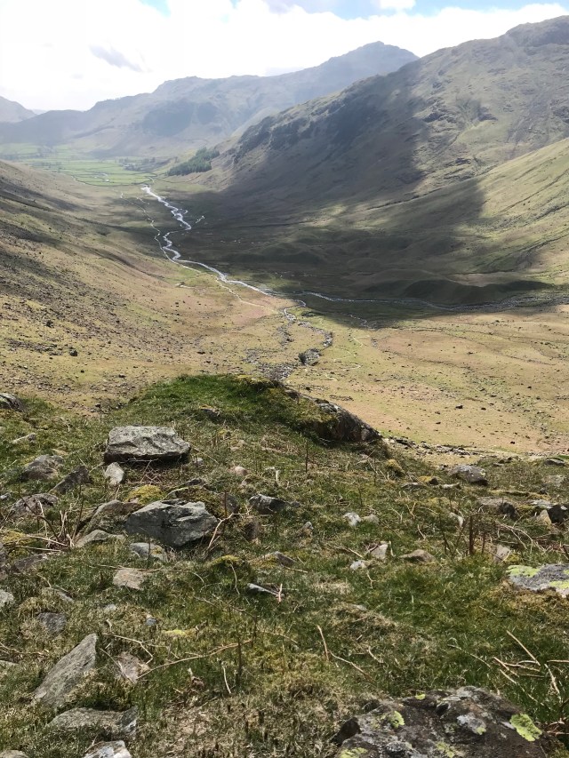
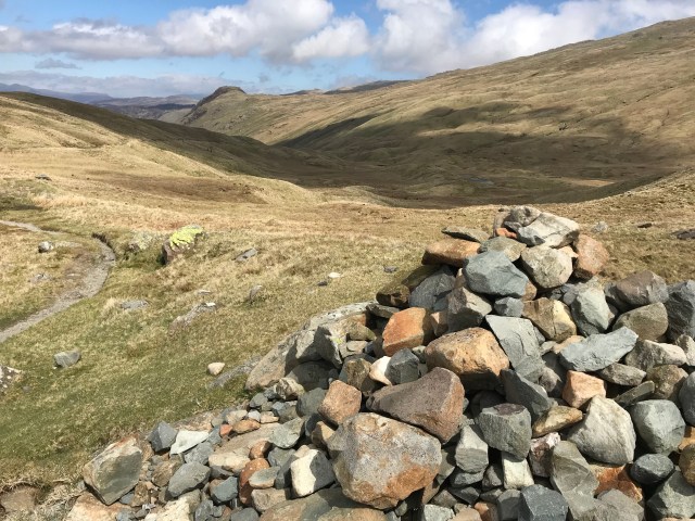
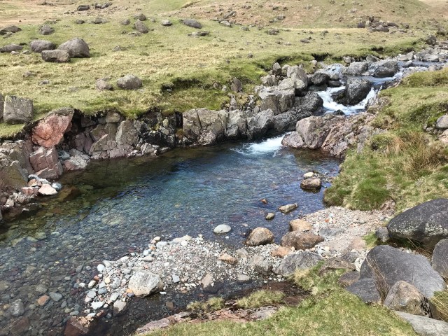
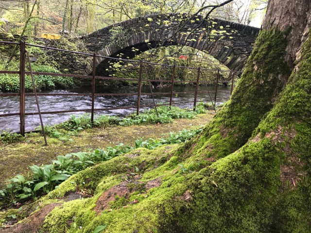
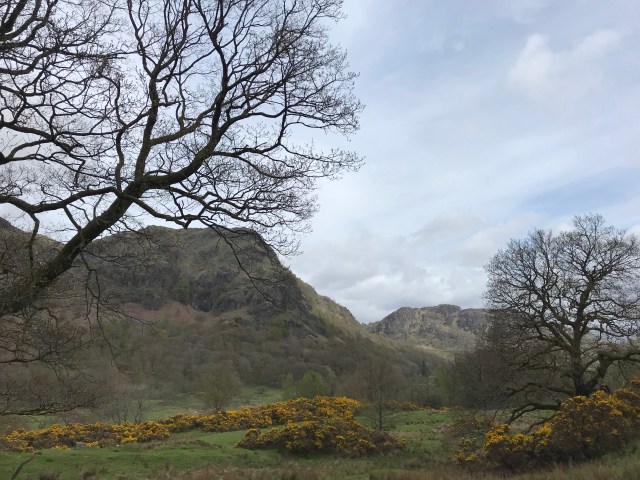
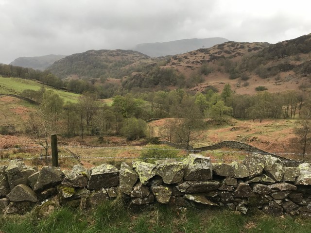
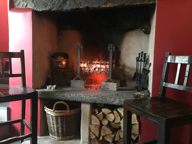
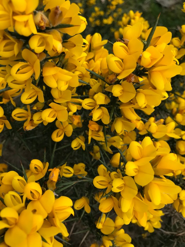
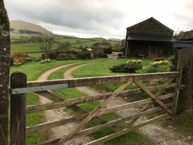
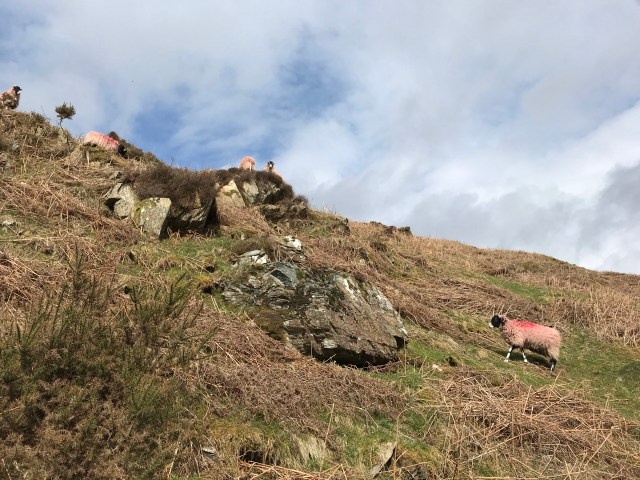
Here’s a few more photos from the day.

Splendid!

Langdale to Borrowdale: My Second Encounter With Mountain Rescue.

I caught the bus from Ambleside to The Old Dungeon Ghyll Hotel, a place I’ve heard a lot about as it appears on many UK hiking blogs. Because the first bus didn’t leave Ambleside until 9:30 and didn’t get to TODG until 10:30ish I didn’t go inside and now I’m kind of sorry. At the same time that day turned out to be the hardest slog yet so I’m glad I didn’t hang around.

The Langdale Valley on a sunny bank holiday Saturday is less a peaceful stroll through a stunning valley and more a walk along a busy high street. So many people! More than I’d seen on all the walks I’d done previously put together. At the end of the valley the track splits off in several directions though so that helped thin the hordes. Also at the end of the valley were a trio of mountain rescue vehicles and I learned from a conversation later in the day that it definitely wasn’t a drill and they’d been there since 8am. No idea what happened though.

As I faced the steep wall of Stake Pass I stopped thinking about other people and mainly started feeling sorry for myself. No one else was carrying a huge pack and it looked like maybe 1000 steps or more to the top, most of them moderately steep and all of them uneven.

I did find, once I got going, that is wasn’t so bad. Because the path had water running down it (they almost all do) and I had to look at every step for footing, I only ended up stopping a few times and with the view getting better and better, it was exciting to climb higher. I’ve never been great with heights but I think this experience is definitely helping me take more risks and be brave. I know some people would bound up stairs like that but for me it was a challenge. When I got to the top I felt like I’d conquered the world.

Over the top was an open grassland area for a short space. It was up here I met a group of uni students from Preston University. We swapped Instagram details at their insistence, then it was down into Borrowdale. Instead of uneven stone steps the path was loose gravel, which is my least favourite surface. I ended up walking on the grass edges on the narrow path that wiggled back and forth. I stopped halfway down and cooked some pasta (taking the advice of several people to actually have decent break when I felt tired) and while I did a man from, of all places, Redcar, came past. This was funny for me because Redcar is a tiny town in Yorkshire and Luke and I stayed in the nearby town of Saltburn last time we were here. The people we stayed with had nothing good to say about Redcar and made this point quite a number of times. Then I meet this guy and he said exactly the same thing.

We had a chat about things other than Redcar and he told me I should definitely do some wild camping at some stage and I agreed (we’ll see) then he moved on. I slowly inched my way down the slope and then struggled along the rocky and muddy valley floor. This was the point that I finally gave up trying to keep my feet dry and just walked through the mud. Within about two kilometres there were about 20 streams to cross and I managed most ok but it was slow going. I met an older couple (I should start tracking how many times I use that phrase) who told me this was as dry as it gets and quite often water is sheeting down the valley walls. Christ almighty.

The water was beautifully clear though.

I decided, as I always do, to stop at the first campsite I came to. It was pretty basic and so busy it looked like there was a music festival going on. I pitched my tent then went in search of the closest pub and had a pint of cider in their sunny beer garden. Lovely!

One Day In Ambleside

Today I once again woke up at stupid o’clock so I walked the mile down to the lake to have a look before breakfast. At least it’s a chance for photos without hoards of tourists.

This is one of the most famous buildings in the area, imaginatively named Bridge House. How do they come up with these things?

I also looked in the window of the realtor’s and picked out a few places that were just what I’d like for a holiday cottage if I sold everything I owned. This area is not cheap!

I also noticed this intriguing display. An unusual way of rounding up the mentally ill, but no doubt it works.

At breakfast I discovered that my American friend from The Sun in Coniston also happens to be staying at The Queen, so we ate breakfast together again and talked about our plans.

Soon after I set off across Ambleside walking without my big backpack and it was marvellous! I headed east out of town, thinking I might just wander around and end up on Loughrigg Fell. I have learned, since I got back, that it is pronounced ‘luffrig’, which is probably the only pronunciation I didn’t try out on other walkers on my way back.

First I walked toward Lily Tarn, or I thought I did. I found a small tarn, then another and then another. I wasn’t sure which was actually the one on the map, but it didn’t really matter. The whole area of Loughrigg Fell is surrounded by roads and villages, it’s pretty difficult to get lost for more than ten minutes.

I walked up to Todd Crag and between two rocky outcrops that perfectly framed an outstanding view south over Windermere, with Ambleside to my east. It was truly breathtaking and yet another walk where I hadn’t seen a soul.

I then struck out towards Loughrigg, which was pretty easy to get up. Although there was a place marked, rather ominously, ‘Black Mire’ near the path. The views from the other side were equally splendid – over to the Langdales and all the shades of green and rusty red. The weather held out and I had a good wander around taking photos.

As I headed down at about 11am I passed the first of dozens of groups heading up the hill. Several people were even fooled, by my serious-looking coat, map and sticks, into asking me for advice and directions, which I spread around liberally without hesitation.

After a pub lunch of fish and chips I visited the laundromat to get the worst of the mud and stench out of my clothes. It’s the first laundromat I’ve ever been in that didn’t sell laundry powder. Luckily there was a machine that still had quite a bit in the slot – I wasn’t about to buy a whole box for one wash. Then I bought a few bits of food for the next leg – which is a bit up in the air at the moment as I’m waiting to hear back from Australasian friends who happen to be in Ravenglass at this very moment, and I’m trying to convince them that a trip to the Muncaster Cumberland Sausage Festival would be a good idea. We’ll see how it pans out tomorrow. I’d be happy to spend another day in Ambleside walking over the hills on the other side of town.

Dinner in the pub, some blogging and reading The Elements of Eloquence by Mark Forsyth. A surprisingly readable book about rhetoric but not enthralling enough to keep me awake. There’s only so much I can take in about anadiplosis, hyperbatons an aposiopesis. Especially after a pint of quite strong scrumpy.

Good night!

Coniston to Ambleside

Keen observers will note that Ambleside isn’t anywhere near the Cumbria Way – I made a diversion late in the day via bus because there was no accommodation in Elterwater. But I shall begin at the beginning!

I had a mostly lovely day’s walking. When I set out from Coniston the sun was out, the birds were singing and I stopped far too frequently to take photos of the countryside and listen to fighter jets zoom overhead as I passed through Tarn How Wood. I watched one come up the valley, flying really low. Another classic Lakeland experience!

I met a group of ladies who were also doing the Cumbria Way and they goggled at my pack. They told me they were stopping at The Old Dungeon Ghyll, probably the most famous walkers’ pub in the Lakes (well, in my limited understanding) but I had a strong feeling I wouldn’t get that far that day, which turned out to be correct.

At some point I took a wrong turn. For most of the walk I had assiduously checked my map every five minutes but I walked through a field of adorable sheep and terrific views and I think I missed a turn.

I ended up heading back south towards Coniston Water instead of north to Tarn How. Fortunately I found a local in my wandering and he looked at my map and set me right and I wasn’t too far out of the way. I ended up walking through a beautiful forest and saying hello to a lady who was also off on a solo camping expedition, the only differences being that she was on a horse and also (I imagine) not suddenly filled with raging jealousy, like I was. Then I remembered that I’m allergic to horses so it’s probably just as well I didn’t try to mug her.

Eventually I made it through the forest and found public toilets, right after spending the previous hour wishing I could find one. How fortuitous! Also it turned out that Tarn How is a super popular spot that people can even get around in wheelchairs so it’s not surprising that there were public toilets. I was grateful anyhow, and walked around a corner of the lake. I’ve heard it described as one of the prettiest tarns in the Lake District. Personally I think it was ok, but maybe the weather wasn’t doing it justice and it didn’t really compare to the magnificence I’d walked through on the previous four days.

I talked to a man who bore a startling resemblance to his bulldog and we discussed dog training for a while then I headed off again, away from civilisation.

This was the bit where the rain started, and it didn’t stop for the rest of the walk. I decided to cut a section off and walk alongside the road for a bit. At one point I heard a loud ‘HELLO,’ and who should I see cycling past but the landlord of the Stan Laurel where I stayed in Ulverston. I literally know two people by face in this whole corner of England and I walk right by one. What are the chances?

I found that the combination of nice solid and flat road surface and rain really sped up my progress and I made it Elterwalter fairly early in the afternoon. I’d set off from Coniston at about 10 and got to Elterwater at about 2:30. I stopped at a fancy hotel, the Eltermere, for a rest stop and had a nice scone with jam and clotted cream, made even more pleasant by their open fire right next to me.

I looked up the accommodation nearby and realised Luke and I stayed at The Britannia in Elterwater last time we were here, but nowhere had rooms and the bus to Ambleside left in five minutes so the choice was made.

I ended up at The Queen’s Hotel, and it was much cheaper than The Sun, although also not quite as nice. I ended up sitting at the bar and chatting to the dour barman and the upbeat barmaid all evening. Well, when I say ‘all evening’ I mean until 7:30, when I went to bed to read and then was asleep by 8:30.

Travelling is tiring! Even though I’m not working I feel exhausted by the middle of every afternoon. Do you find this when you’re on holidays? Maybe I need to develop a coffee addiction so I can push through 🙂 .

Cumbria Way : Day 2

Most people would walk to Coniston in their first day of TCW but I am a bit unfit and quite lazy so I decided to get there on day two. Also people in other blogs said the last few kilometres by Coniston Water are a real slog and I wanted to enjoy it.

I actually slept better than in the hostel in London. Nothing beats an absence of snoring. Nothing!

So I had a cold and small breakfast (having a huge Full English Breakfast before saddling up for a major walk seems like insanity to me, but it’s tradition here) of cheese and hummus on tortillas, then set off.

If I didn’t see many people yesterday, I could halve that number today. I saw literally no one, not a soul, for the first four hours. I have read that the Lake District can be heaving with tourists all year round but that hasn’t been my experience so far. Maybe I’m not in the busy part yet? Anyhow, I enjoyed the views and took my time.

The stream above was my last view before I climbed a hill to reach Beacon Tarn, my first proper geographic feature.

And still no one in sight.

I sat to dry out my map (I’d used it as a ground sheet the night before – it was a waterproof OS map. So useful!) and have a snack and look at the water. After twenty minutes I looked behind me and a bunch of sheep had snuck up and were giving me baleful looks.

I like sheep. They are quiet and easy to ignore. Not like cows! Anyhoo, right after Beacon Tarn the landscape really opened up and there was a fabulous vista across to the Langdales. Probably. Someone correct me if I’m wrong.

While the landscape was stunning it was also difficult to walk across. The path couldn’t decide whether or not it wanted to be a stream or a bog, and so in many places it was both.

The problem in the photo above isn’t actually the steam crossing, it’s the getting to and from – it’s all mud. I spent a lot of time walking back and forth at places like this, working out how to keep my feet dry. I succeeded though, so in your face, nature!

I will admit that the pack continued to weigh on me, and after about 10 km I got to a point where I was just bent over, dragging my walking poles like a cave man would drag his club and thinking tired thoughts. Fortunately I came to a stream that had a grassy bank, wildflowers and sun shine. It was time to sit down.

Over the next hill was Coniston Water and also phone reception. I took this stretch pretty easy, stopping to take photos, upload a few photos and rest every kilometre. My shoulders were getting very sore and dark clouds were rolling in.

Eventually I staggered into town and found The Sun Inn and a bunch of other walkers outside. I ended up sitting with them for a few hours then booking into the hotel when the rain started coming down in sheets.

I cannot tell you how good my pie and chips tasted. I might have even had a small tear in my eye at the fact that I was indoors by an open fire, I’d walked through stunning scenery and I had a comfy bed and my own private, indoor bathroom to use for the first time in nearly a week. In fact it was so good I booked two nights.

Marvellous!